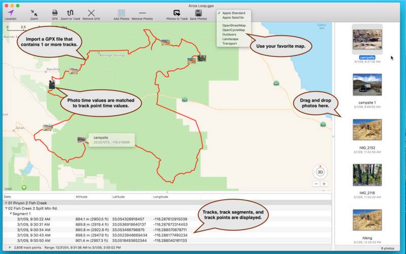
GPX Photo Tagger geotags photos (JPEG, PNG and TIFF files) by matching photo time & date values to GPX track time & date values. Here’s how it works:
1. Open a GPX file that contains one or more tracks. The tracks are displayed on the map.
2. Add some photos.
3. Click the Photos to Track button. This matches the photo time and date values with the track time and date values, placing a small photo icon on the track representing each photo’s map location. Optionally drag the photo on the map to a new location.
4. Click Save Photos. This saves the new coordinate information to the photos. The altitude from the nearest track point (if available) can also be saved with the photos.
Download sample data from http://www.modesittsoftware.com/GPXPhotoTagger/Sample_Data.zip
That’s it! Questions, comments, or suggestion, please contact us.