Do you want to show where your pictures were taken? Have you ever thought that it would be great to add gps information to your photos?
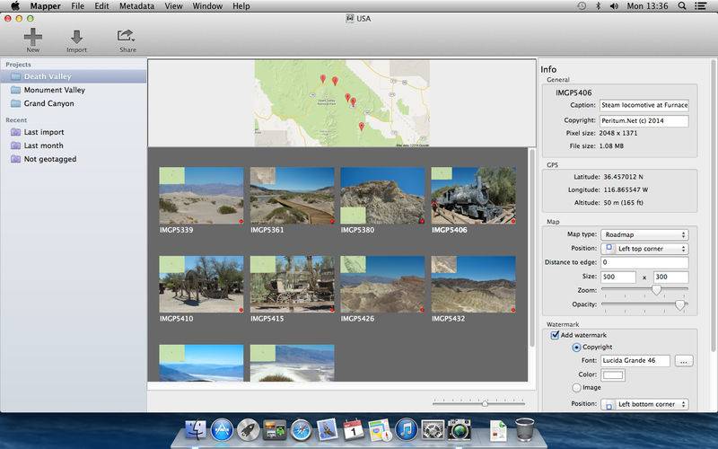
Mapper is an easy-to-use geotagging app, which enables you to add maps to your photos. You can also add watermarks and create number badges which allows to easy marking your pictures.
Photos are organized into libraries and projects, for every project you can create index map, which shows where every picture were taken.
Created pictures you can easly export or send to Facebook.
Feature highlights:
* Add maps to photos in variety styles (roadmap, terrain etc), sizes and positions
* Add watermarks to photos using own text as well as own logo (imported from picture)
* Organize your photos using projects
* Create index map for projects
* Read exif gps information from previously geotagged photos
* Add and adjust gps positions on map
* Mass add locations to photos using GPS track files
* Opens GPX and TCX track files
* Export pictures with created index map to disk
* Upload photos from within application to Facebook
* Send photos from within application using email.