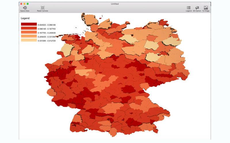
This software can build 3d view of your geography data,(for example .shp file) with interactivity in real time.If you want a 3d view of your map,this is the best choice.
1.Map can be coloured by category value or gradient value.
2.support 5 kind of gradient interval method(Equal interval,quantile,nature breaks,standard deviation,pretty breaks)
3.height value can be fixed or varied .
4.real time interaction.