_ PROMO LAUNCH PRICE FOR FEW DAYS _
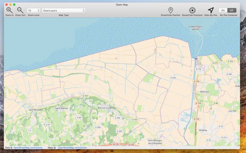
Open Map brings on the Mac many maps of the open standard map world.
Open Map covers all the world exactly as other well know proprietary formats but with more then 60 map types with different style, graphic and also data, always up to date, available with 1 click with a resolution level ranging from 0 to 28.
All inside this native Cocoa application optimized only for Mac that allows you to scroll, move, zoom in and out to any level you like of any point of the globe.
A must have for anyone working with maps, from designers to developers, to evaluate map types or to produce PDF map images of various area or other purposes.
Open map has them all in one place.
Application can natively export at any time any visualised map as PDF, PNG, TIFF,JPEG using any scale and area.
Some of the available maps:
• Wikimedia
• Humanitarian
• Black & White
• OpenTopo
• Hike & Bike
• Hydda
• Toner
• Terrain
• Watercolour
• Positron
• Dark Matter
• Flat Blue
• Roads
• Hybrid
• Contour
• Grayscale
• Street
• Topo
• Imagery
• Shaded Relief
• LightGray
• NatGeo
• Delorme
• Ocean
• OpenCycle
• transport
• Landscape
• Pioner
• Atlas
• Outdoor
• Satellite
• Lyzidiamond
• Street Satellite
… and many others
… and more to be added in the next releases
Open Map can also visualize your position and precision range via geo wi-fi and update it over the map if you are moving
Note:
Geographic data are served via internet by various servers.
To visualize maps and associated data, an internet connection always on is required.
We have also an iOS version for iPhone and iPad.
Please look in the iOS App Store for Open-Map