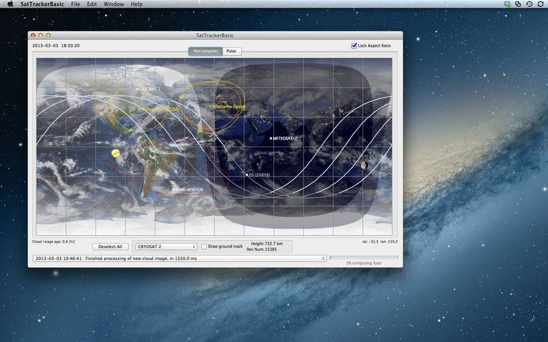
SatTrackerBasic is designed for real-world prediction of satellite ground tracks. It is highly accurate and, with fresh sets of orbital elements downloaded from within the application, it will keep that accuracy indefinitely. It provides ground tracks for multiple satellites, like some other applications, but unlike any other, it will compute visibility for multiple ground stations.
As well as ground tracks, the application calculates daytime, twilight and nighttime regions as well as calculating when each satellite is illuminated so that it can be seen – assuming there’s no cloud. To help with this, SatTrackerBasic also displays global cloud cover on a daily or (in some cases) a three-hourly basis. The various items which can be plotted are completely configurable, and so is the representation. The map can be displayed in two map projections: a simple rectangular projection or as a pair of azimuthal projections centred on the North and South poles.
Powerful database functionality is built-in to allow the management of thousands of satellites and ground stations.
Features:
- plots satellite positions and ground tracks;
- Sun and Moon position (and moon phase) are plotted;
- maps show the day and night coverage on the Earth;
- the time can be adjusted freely forwards and backwards, and run in simulated future or past times;
- current cloud cover is optionally downloaded and displayed;
- the location of the South Atlantic Anomaly (which can affect satellite operations) is shown for a given satellite;
- ground station horizons are plotted, taking account of the real horizon obstructions, for both transmit and receive links;
- ground stations are grouped into related sets;
- plots are either on a rectangular grid or a pair of polar projections;
This application has actually been used in planning real satellite operations!