This is a GIS (Geographic Information System) software,you can use it to view shape file and usgs dem file, modify the attribute table etc.
Feature layer (point, line, and polygon layer)
• Add and edit points, lines, or polygons
• Render type: Simple, ClassBreak, Categories (according to the attribute table)
• Symbol layer type of point layer: Simple marker, Character marker (You can enter any character)
• Fill type of polygon layer: Simple, Gradient, Hatch, Picture
• Attribute table adds other datas from table (similar to Join, but no correlation)
• Setup chart
* * * * * Attribute table * * * * * ( See the second screenshot below )
* * * * * Tool box * * * * * ( See the third screenshot below )
Projection system
• Geographic systems, Projected systems
• Projection transformation
Import and Export
• Import Scatter plot (*.txt, *.dat, *.csv, *.tab) Details
The points coordinates and attributes are automatically added to attribute table while importing Text file.
• Import and export DXF (*.dxf)
• Import and export ESRI Shapefile
• Import and export TYGrid (*.tyGrid)
• Import DEM USGS DEM (*.dem)
• Import Binary golden software grid 6 / 7 (*.grd)
• Export Binary golden software grid 7 (*.grd)
• Import and export ASC Arc/Info ASCII Grid (*.asc, *.aig, *.agr, *.grd)
• Import and export Image
PDF (Vector) (*.pdf) Recommended Use When exporting
TIFF (*.tif, *.tiff), JPEG (*.jpg, *.jpeg), PNG (*.png)
• Export KML (*.kml)
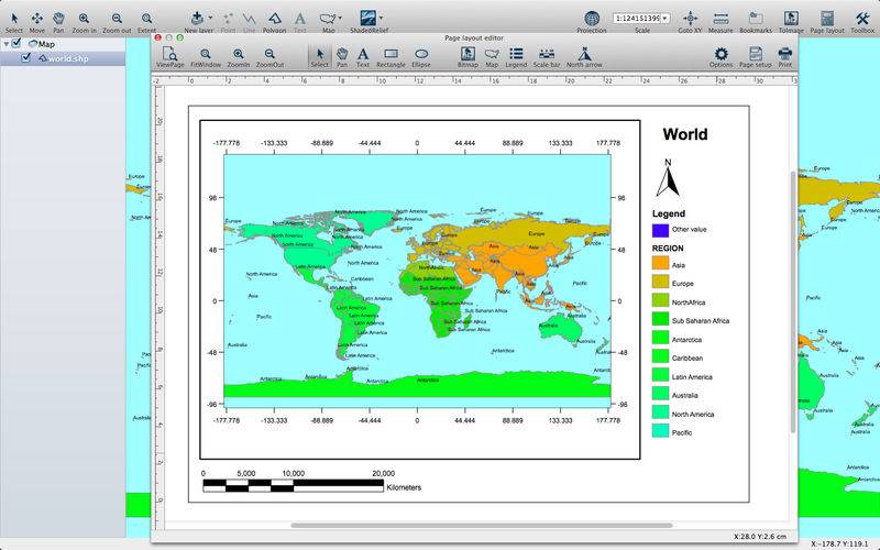
Page layout
• Grids to the map
• Legend, Scale bar, North arrow
• The basic drawing: Text, Rectangle, Ellipse, Bitmap
• Change the background color of the map
Video tutorial
https://www.youtube.com/playlist?list=PL3BrLKH7KamuemCGleGkCCWuRGCThmL0T
Blog
http://tyevolution2014.blogspot.com/